GRATICULE
Postcode Points Locator Data UK
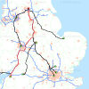
Graticule supplies Postcode Point Locator Data UK with a comprehensive list of postcodes with their point location specified by Easting and Northing co-ordinates in the National Grids of Great Britain and Ireland and/or in Longitude and Latitude co-ordinates in the World Geographical Referencing System using wht WGS84 model of the shape of the earth.Graticule's Postcode Point Locator Data UK provides a compprehensive lcontactist of all postcodes in the UK (excluding Post Office Box Postcodes). The data is widely used for applications involving mapping of contact addresses in applications such as Graticule's PostcodeAnalyst Software, AptMap Software and PostcodeCalculator 2 software. The data is also widely used for specifying the start and end points for trips by road for planning routes, determining shortest or fastest routes, measuring driving distances and deriving estimates of off-peak driving time and costs.Postcode Points Locator Data UK is widely used in organisations and businesses operating in many different economic sectors in the UK. For example, it is being used to map the locations of retail outlets and their customers; to find contractors and clients on the basis of proximty by road; to create maps showing the location of schools and the residential address locations of students; mapping hazard and risks for insurance, financial and environmental services; site analysis for planning retailing outlets by computing driving distances, driving times and evaluation of accessibility, catchment area and population and lifestyle analysis using geodemographic data by postcode sectors and contacts address postcodes. There are many different applications which make use of Postcode Points Locator Data UK.Postcode Points Locator Data UK is supplied in ASCII Text Comma Separated Value (CSV) format with optional extra sets of data to meet your requirements. The structure of the file of data is as follows:Postcode Easting Northing Longitude Latitude LS2 9AE 1234567 1234567 -1.1234 52.1234Graticule provides samples of the Postcode Points Locator data. Please use the inquiry form to submit your requriements: http://www.graticule.com/contact
- Projection: National Grid
- Filetype: ASCII Text CSV file
Features Postcode Points Locator Data UKUp-to-date geo-coded postcode data of UK with Easting and Northing co-ordinates in the National Grid and Longitude and Latitude co-ordinates in the WGS84 model of earth.Benefits Comprehensive set of PostcodesUp-to-date set of full postcodes with one update supplied with annual licences for use of the data,Revised twice each yearRevised sets of Postcode Points Locator Data UK are supplied every six months