GRATICULE
MapGPS.DLL for Windows
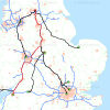
MapGPS.DLLfor Microsoft Windows enables developers to create applications which use data from mulitple satellite global positioning system receivers in vehicles.MapGPS software enables a developer to create applications which read data through a serial port in NMEA format from multiple GPS receivers in vehicles and create a standard record with an ID, Longitude and Latitude co-ordinates in the WGS84 spheroid model of the earth, date and time.Data can be read from a serial port or a file stored on disk. A multi-threaded library for fast processing of streams of input data from multiple GPS receivers, MapGPS software enables developers to create applications which capture and store data and which monitor data from multiple GPS receivers in a fleet of vehicles.Each source of GPS data is handled using a separate thread. Threads can be started, destroyed, paused or resumed. Threads run independently of one another and can be referred to by their unique identification number.A user can create an application which specifies required NMEA strings to decode when starting a thread and can decode single- or multiple-NMEA strings. With several GPS satellites in view and data is being received every second from each, multiple threads can process streams of data in a fast, effective and efficient software solution.MapGPS software was designed and built to capture, store and monitor the locations of multiple assets such as vehicles or other field equipment. The software enables a developer to capture all of the available data from GPS receivers or to sample the data at intervals such as every 10,30, 60 or more seconds. This gives develoeprs the opportunity to create custom applications which capture, process and store the time and location of each asset all of the time anywhere in the world.MapGPS software has been used by developers to built a broad range of custom applications. These include applications for managing and monitoring fleets of up to 50,000 vehicles for insurance companies, leasing companies and others. It has also been used by developers to build vehicle asset and security applications with maps showing the location and tracking of a particular vehicle, monitoring in near real-time the location, speed, direction of travel and other variables of a vehichle such as a bullion delivery vehicle, other vehicles with valuable loads and stolen vehicles.The illustration on this page shows the results from processing multiple threads using the MapGPS software on a computer running a Microsoft Windows environment.