GRATICULE
PostcodeAnalyst Digital Mapping Software
Graticule's PostcodeAnalyst Digital Mapping Software for computers running Microsoft Windows 8, 7, Vista or XP environments lets you locate and map your contacts by postcodes in the United Kingdom, its regions or local areas. A contact can be an individual or an organisation with a postal address and postcode in the UK.
Graticule's PostcodeAnalyst Digital Mapping Software is comprised of a mapping engine with functions for creating a new named project, retrieving maps by project name, display of colour or black and white maps, scrolling over a map, changing the scale of a map, importing data from a database or spreadsheet file, creating map overlays of your imported data, creating thematic maps showing the geographical distribution of your contacts by product or service, creating custom sales territories with names, automatic saving of maps, printing and saving of colour maps with overlays as Acrobat files and a range of tools for performing geometric functions on maps.
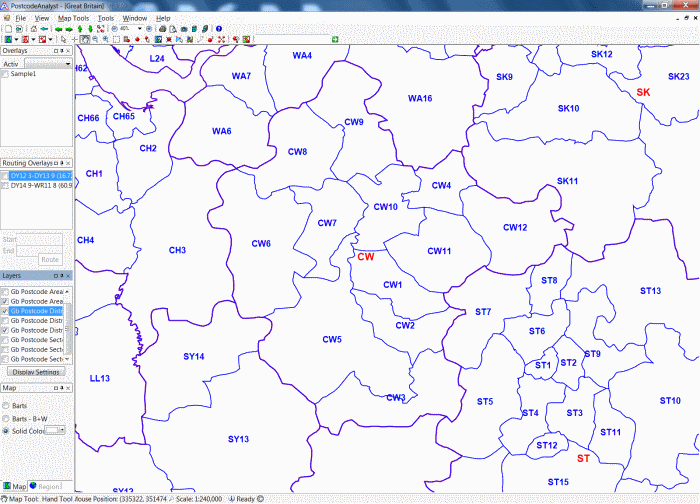
Illustrated opposite is the screen layout of Graticule's PostcodeAnalyst Digital Mapping Software with menus along the top, panels down the left-hand side showing the overlays, layers and maps data which you have installed and the mouse pointer, mouse position, scale of map and copyright notice along the bottom. There is no map on screen.
Graticule's PostcodeAnalyst Digital Mapping Software was designed and implemented as a series of individual software and data libraries or plugins. The plugins enable a user to extend the range of functions or digital map, postcode and gazetteer data to meet his or her requirements. The plugins are optional, can be added at any time and revised individually as new functions are required or when revised sets of data become available.
Graticule's PostcodeAnalyst Digital Mapping Software can be used with many different types of vector and raster digital map data, postcode points data, gazetteer data and statistical data of Great Britain or the United Kingdom. This offers users a choice of types and scales of digital data for the geographical areas of their choice.
Graticule's PostcodeAnalyst Digital Mapping Software lets you manage your work by projects. You can open new project, give it a name and all of the maps which you create can be recalled by opening the named project. Each map view, overlay and other data will be stored in a database for the named project. This enables you to retrieve all of the maps and related work for each project by name and makes it easier to manage your work.
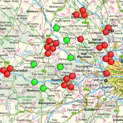 Illustrated opposite are locations of customers by product purchased on overlays of OS MiniScale Colour Raster Map of Great Britain in Graticule's PostcodeAnalyst Digital Mapping Software.
Graticule's PostcodeAnalyst Digital Mapping Software enables you to import a database or spreadsheet file containing a list of names and addresses of your contacts and other data. When you import a file, a wizard takes you through a series of steps including choosing a symbol by shape, size and colour for the named map overlay file and automatically placing the symbol over the location of your contacts. You can do this at four different levels: (i) by postcode area centre; (ii) by postcode district centre; (iii) by postcode sector centre; or (iv) by postcode unit centre. This lets you to create maps at four different levels or scales showing geographical distributions of customers, suppliers, employees, students, patients or social contacts in Great Britain or the UK.
You can also create thematic maps showing the number of contacts you have within each postcode area, district, sector or unit. You can count the numbers within each postcode polygon (Area, District, Sector or Unit) and create statistical or thematic maps showing the selected postcode zones with \""Very High\"", \""High\"", \""Average\"", \""Low\"" and \""Very Low\"" numbers. You can choose a hue or colour and five different shades of a colour to portray the different categories of contacts on one or more thematic maps. Each map is created on a map overlay which is stored as named file on your computer.
PostcodeAnalyst Digital Mapping Software has a range of functions for creating and managing projects, creating maps of geographical distributions, maps showing changes in these distributions of a month, quarter or year, creating maps at different scales, with different map content, at local, regional, national or international scales, capturing images of maps, printing maps and saving maps as part of each project.
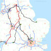
 Illustrated opposite are the map boundaries of Postcode Districts with labels as two map overlays in the Crewe Postcode Area in PostcodeAnalyst Digital Mapping Software.
As most businesses operate in geographical space, maps offer a neat, compact and synoptic view of business activities over any chosen period such as a week, month, quarter or year. Maps provide a view of business activities over geographical space and enable business managers interpret and analyse where there are high concentrations and gaps in the geographical distribution of customers or clients. Managers can often infer from viewing maps the likely reasons for geographical distributions and take account of these for planning and managing a business.
Maps can play a critically important part in sales territory planning, marketing campaigns, market research, capturing sales statistics by postcodes, locating customers and outlets, organising transport, route planning, measuring distances, driving times and estimating costs of trips, deliveries and more. Graticule's PostcodeAnalyst Digital Mapping Software with plugins offer effective technical solutions for high quality custom mapping.
Optional Plugins for PostcodeAnalyst Digital Mapping Software
Graticule supplies several optional plugins for its PostcodeAnalyst Digital Mapping Software which extend the range of functions or the types of data.
- Telemappix Database Connectivity Wizard Plugin enables you to connect over an intranet to a remote database management system and perform SQL queries to select and import a chosen set of data into Graticule's PostcodeAnalyst Digital Mappping Software as a file. Data can be imported to map overlays which appear screen. The Telemappix software is a productivity plugin: it greatly improves speed, efficiency and productivity of importing your data to map overlays as a named file.
- RouteCalcalator plugin enables you to find the shortest route from one location to another by road such as from one postcode to another postcode, from one town to another using the Gazetteer plugin or from two locations specified by Easting and Northing co-ordinates in the National Grid of Great Britain or Longitude and Latitude in the World Geographical Reference System. The RouteCalculator plugin returns routes as a map overlay, distances in miles and kilometres and off-peak driving times in hours and minutes. It enables you to calculate costs of trips using a rate per mile for a vehicle and/or employee.
- RangeCalculator Plugin lets you compute the drive-times about a given point on a map on the screen. It computes how far you can drive by road in all directions from a chosen starting point. It produces a map overlay showing drive-times by road in 5 minute intervals up to 30 minutes.
- Geodemographix Plugin. This plugin enables users to create map overlays with pie, bar and other graphical symbols to represents statistics. It is a valuable plugins for creating attractive maps with a wealth of information.
- Postcode Unit Points Data GB Plugin provides some 1.7 million full postcodes with Easting and Northing Coordinates in the National Grid of Great Britain and Longitude and Latitude Coordinates in the World Geographical Reference System using the WGS84 model of the earth. The plugin enable you to plot the location of your contacts using the full postcode string at postcode unit level. A postcode unit is typically a group of 10 -17 residential addresses in on one side of a suburban street, a single farm or business.
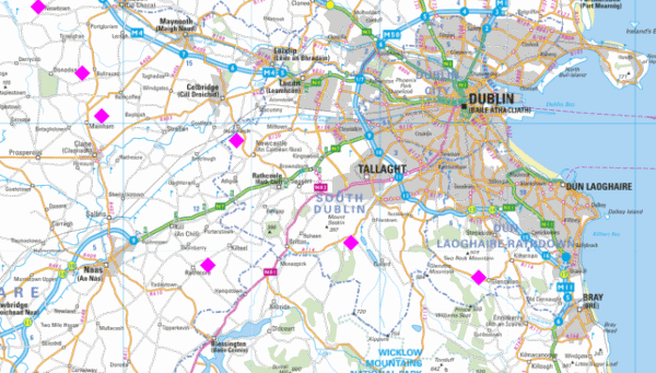
Illustrated opposite is a map showing the location of customers around Dublin by purple diamonds on a map overlay over a Collings Bartholomew colour map in PostcodeAnalyst Digital Mapping Software.
- OS Code-Point with Polygons GB plugin provides vector postcode unit boundaries maps with Code-Point Data of Great Britain. When used with the OS District Raster colour map data at a scale of 1/25,0, you can create maps with overlays showing individual buildings, street names and postcode unit maps to locate your contacts using the full postcode string. You can create territories by selecting postcode unit areas. You can create thematic or statistical maps by counting the number of contacts in each postcode unit or territory. This gives a high level of detail for market research, mapping
=\""PostcodeAnalyst Software with OS Code-Point with Polygons showing Postcode Units in part of Exeter.\"" src="/sites/default/files/pictures/PA%20with%20Postcode%20Units%20Exeter
.png\"" style=\""border-style:solid; border-width:2px; float:right; height:357px; width:595px\"">customers, outlets, crime, catchment areas for schools, banks, medical and dental pr
actices and other applications. - OS Gazetteer Plugin GB privides a list of cities, towns, villages and other place names in Great Britain with their Ea
sting and Northing coordinates. You can enter the names of two places in a dialogue box in PostcodeAnalyst software and obtain the shortest distance by road and off-peak, drive-time
between them. Distances provide valuable information for planning trips, working out costs and claiming expenses.
Illustrated opp
osite is a screen shot of Gratcule's PostcodeAnalyst Digital Mapping Software with Ordnance Survey (OS) Code-Point with Polygons showing postcode unit on an overlay over an OS Distr
ict Vector (Raster) map at a scale of 1:25,000 of part of Exeter with street names, buildings, rivers, railways, stations and other features. Used for market research, mapping
the location of customers, outlets, crimes, medical practices and patients, schools and students and many other applications.
- OS District Vector (Raster) M
ap Data Great Britain Plugin provides colour raster maps with streets and buildings at a scale of 1/25,000 so you can plot the location of your contacts in great detail, na
vigate your way around each delivery point or contact and derive detailed maps showing the number and geographical distribution of your contacts in a chosen area. - Co
llins Bartholomew UK and Ireland Panorama digital colour raster map data at scales of 1:200,000 and 1:800,000 so you can plot the locations of your contacts on multiple map
overlays and view their geographical distributions. &n
bsp;
-
li>Postcode Map Boundaries UK (Area and District) plugin provides vector map data showing the geographical distribution of postcode areas such as Aberdeen (AB) and
- OS Mini-Scale Colour Raster Map GB plugin provides a colour raster map of Great Britain at a scale of
1/1,0,000 showing the major physical and topographic features. An attractive map for showing the location of your business outlets, depots, warehouses or factories in Great Britain
, you can place an icon of a chosen colour, size and shape over the postcode of each outlet.
postcode districts such as Aberdeen District 3 (AB 3). The postcode areas, districts, sectors and units are polygons which can be used for thematic or statistical mapping. The choic
e of areas, districts, sectors or units depends on your particular application. Areas are probably best for obtaining a map of Great Britain; districts for a selected region of Grea
t Britain; sectors for viewing parts of a city such as Leeds; and units for mapping part of a suburb.Postcode Map Boundaries UK (Sector) plugin provides vector map
data showing each postcode sector such as Leeds LS7 2.
Platforms
nments and with at least 1 Gb of Random Access Memory and 300 Mb of free hard disk space. More memory and hard disk space may be required for some large sets of digital
map and postcode data.
Digital Raster Map Data
Graticules PostcodeAnalys
t digital mapping software can be supplied with different types, content and scales of map data for chosen geographical areas such as the UK, Ireland, Europe or USA and Canada. 
; The types of map data are vector maps and raster maps. The content and scales are related to one another. Small scale maps at 1/1,0,000 of Great Britain show the whole count
ry with major geographical features such as cities, rivers, roads, mountains and lakes and provide a good overview of the geographical area. Large scale maps show more details of th
e road network, railways, rivers, lakes and towns. Most people require a maps at a range of different scales and content for undertaking projects.
-
font-size:14px\"">Collins Digital Map Data of UK contains digital colour map data of the main roads, rivers, cities, towns and other features at 1/800,0, 1/500,000
and 1/200,000 scales. - Ordnance Survey Digital Map Data of Great Britain includes the Mini-Sca
le 1/1,0,0, the more detailed 1/250,000 and street maps at 1/25,000 as vector and raster digital maps. - Ordnance Survey vector
map data of the road network of Great Britain at a scale of 1/50,000 for vehicle routing, measures distances, off-peak drive times and costs of trips between two points or
postcodes. - Collins Bartholomew Western Europe Raster Map Data at different scales to enable mapping the location of
you business contacts across Europe; - Collins Digital Map Data of UK and Ireland showing cities, towns, roads, river
s, railway lines, coastlines and county boundaries for locating and geographical information solutions for visits, delivery of goods and services and more. - Royal Mail Postzon Data of the UK
Features
| Read your own data | Import names, a ddresses, postcodes and other variables from your contacts address database; |
| Locate your contacts | =\""font-size:14px\"">Map contacts on semi-transparent map overlays with a descriptve file names for each overlay; |
| Interpret maps |
View, interpret, analyse and compare maps of your data showing many variables over chosen periods; |
| Capture images of maps for reports, presentations and websites in standard format s; |
|
| Graphical user interface | Intuitive interface for scrolling, changing scal es and other functions with attractive colour maps of UK. |
| Manual and tutorial | ">Online manual and quick-walk-through guides to help you get started. |
| Optional plugins | size:14px\"">Functions for route finding, driving distance, driving times and SQL database connectivity wizard. |
| Microsoft Windows | Runs on computers and devices with Microsoft Windows XP, Vista, 7 or 8. |
| Contains digital map data | Contains embedded colour maps and postcode boundaries digital maps. |
|
Gographical distributions |
Create maps showing customers by product, sales value, repeat business for a chosen period. |
|
View, interpret and analyse |
Create monthly maps of geographical distributions of customers and analyse changes over time. |
|
Assess campaigns |
Analyse campaigns by mapping customers response to leaflets, adverts or special offers. |
|
Sales and market planning |
Plan marketing strategies with territory maps for analysing sales by postcode areas or zones. |
|
Find contacts in vicinity |
|
|
Map sales of products |
Create maps of sales by products, value, revenue, profitability and compute delivery charges by road |
|
Capture data by areas |
Capture all contacts within a circle of a chosen radius centred on a postcode or rectangle. |